No products in the cart.

Drone Mapping Syllabus PDF: Learn Advanced Techniques

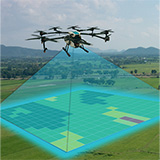
The Drone Mapping Syllabus PDF is a detailed guide for mastering advanced drone mapping techniques and geospatial technologies. This intensive 3-month program provides practical, hands-on training in:

  • UAV Photogrammetry
  • LiDAR
  • GIS Software
  • Terrain Mapping
  • GPS-based Flight Planning

Designed to equip professionals with the skills needed to excel in industries like construction, environmental monitoring, and urban planning, this course emphasizes precision data acquisition and analysis.

From creating high-resolution maps to generating actionable insights, the curriculum ensures learners can produce professional-grade outputs that meet the demands of various industries.

Step-by-Step GIS Drone Course Structure PDF for Beginners

The drone course structure outlines a comprehensive framework for integrating drone data with Geospatial Information Systems (GIS).

The GIS Drone Course Structure PDF focuses on transforming raw UAV data into actionable insights through spatial analysis and visualization.

Participants will gain skills in managing, interpreting, and analyzing geographic data to support strategic planning and decision-making processes.

  • The course structure includes training in data integration, sophisticated visualizations, and performing spatial analyses tailored to industries such as urban planning, environmental monitoring, and resource management.
  • Mastery of these GIS applications positions learners as valuable assets in sectors that depend on geospatial intelligence for infrastructure development, sustainability projects, and land-use planning.

3D Modeling & Terrain Mapping

Another highlight of the course is training in 3D modeling and terrain mapping, where participants learn to create detailed visual representations of landscapes and structures.

This module teaches learners to transform drone-captured data into accurate 3D models using software like Pix4D and Agisoft Metashape.

These skills are indispensable in industries like construction and real estate, where clear insights into terrain and structural details drive project success.

From topographic mapping and volume calculations to virtual walkthroughs and simulations, the ability to generate and analyze 3D models enhances decision-making processes and ensures project efficiency.

GPS-Based Flight Planning for Large-Scale Surveys

Efficient flight planning is a critical skill for professionals conducting large-scale drone surveys.

  • This module focuses on using GPS technology to plan optimized flight paths that maximize data collection efficiency.
  • Participants will learn to account for factors such as battery life, terrain, and weather conditions, ensuring seamless operations.
  • Whether assessing infrastructure, conducting environmental surveys, or mapping agricultural fields, this training ensures that projects are completed on time and within budget.

Remote Sensing Techniques for Environmental Monitoring

Remote sensing is a vital component of drone mapping, particularly for environmental and geological applications. This module explores the use of multispectral and thermal imaging sensors to capture data on vegetation health, surface temperatures, and water quality.

Participants will learn to process and analyze this data to detect environmental changes, support conservation efforts, and assess land use.

These capabilities are invaluable for projects like reforestation, mineral exploration, and climate change monitoring. By mastering these techniques, learners will contribute to sustainable development and ecosystem preservation initiatives.

Why Choose Drone Mapping & Geospatial Technologies Training?

  • This course combines theoretical knowledge with practical expertise, providing a structured approach to mastering drone mapping and geospatial technologies.
  • The focus on UAV photogrammetry, LiDAR, GIS, and remote sensing ensures participants gain versatile skills applicable across industries.
  • At the end of the training, you will have access to the UAV Course Syllabus PDF, a comprehensive resource consolidating all modules for ongoing reference and professional development.

Dr. Arvind Kumar has over 15 years of experience in UAV technology and geospatial sciences. He specializes in integrating AI-driven automation in drone operations. As a DGCA-certified drone pilot, Dr. Kumar is passionate about sharing his knowledge with aspiring drone professionals, helping them excel in this transformative field.

Dr. Arvind Kumar

With over four years of diverse experience spanning technical and managerial domains, Chetna Sharma has consistently demonstrated leadership, innovation, and adept project management skills in alignment with DGCA guidelines. Her journey has been marked by a passion for driving technological advancements, particularly in the realm of unmanned aerial vehicles (UAVs) and drone manufacturing.

Chetna Sharma

Drone Mapping Careers in India: A Growing Opportunity

Drone mapping and geospatial technologies have revolutionized data collection and analysis, making it very simple to get career opportunities. Drone Mapping Careers in India are gaining momentum as industries like agriculture, construction, and environmental conservation increasingly rely on UAVs (Unmanned Aerial Vehicles) for accurate geospatial intelligence.

This course in Drone Mapping & Geospatial Technologies equips you with practical knowledge of:

  • UAV photogrammetry
  • LiDAR
  • GIS software
  • 3D terrain modeling

By mastering these advanced tools, you can contribute to projects that demand precision, efficiency, and innovation.

From creating detailed maps for urban planning to analyzing land use for sustainable development, this field offers a dynamic career pathway.

Drone mapping professionals play a critical role in ensuring the success of large-scale projects, offering the technical expertise needed to collect, process, and interpret data that shapes modern industries.

Top Industries Offering Geospatial Drone Opportunities in India

The rising demand for geospatial intelligence has unlocked numerous Geospatial Drone Opportunities in India across a variety of industries.

Graduates can work in:

  • Urban Planning
  • Land Management
  • Construction Surveying
  • Infrastructure Monitoring

This course prepares you to handle large-scale projects requiring accurate GIS data and 3D terrain models.

Geospatial professionals trained in drone mapping are indispensable in tasks such as creating digital elevation models, monitoring infrastructure, and assessing environmental changes.

These roles are especially critical in urban development projects, where the integration of accurate geospatial data supports efficient planning and resource management.

Advanced training in drone mapping allows you to work with cutting-edge tools like Pix4D, Agisoft Metashape, and other industry-standard software to process data into actionable insights.

As India continues to embrace drone technology for geospatial applications, skilled professionals will find themselves in high demand across sectors ranging from real estate to disaster management.

Top UAV Jobs in Land Management to Boost Your Career

The widespread adoption of drones in land management has opened countless “UAV Jobs in Land Management” offering exciting opportunities for professionals trained in geospatial technologies.

These roles involve using drones to optimize land use, monitor natural resources, and conduct topographic surveys essential for planning and development.

Professionals in this field are critical for industries like:

  • Forestry
  • Agriculture
  • Environmental Conservation.

They provide detailed data to support land-use decisions that balance economic development with sustainability.

From mapping terrains to identifying areas for reforestation, UAV experts ensure that land management practices are both effective and environmentally responsible.

Completing this course not only equips you with the technical skills needed for geospatial applications but also positions you as a key contributor to India’s development initiatives.

Alumni Success Stories

Jaikant Namdeo

"Arjun Mehta, a proud graduate of the Advanced Drone Mapping & Geospatial Technologies program (Class of 2023), has successfully leveraged his training to excel in precision agriculture. Reflecting on his journey, Arjun shares, "This course transformed my career, helping me secure a role in precision agriculture and contribute to advancements in the field."

Arjun Mehta
Shifa Parveen

Shekh Rashid, a graduate of the Drone Assembly & Operation and Certifying Piloting program (Class of 2023), has successfully transitioned into a fulfilling role as a UAV Trainer. Shekh shares, "This course was exceptionally well-structured and informative, helping me secure a role as a UAV trainer. Thank you, Project Pankh!"

Shekh Rashid
Prince Shukla

Sachin Kushwaha, a graduate of the Drone Assembly & Operation and Certifying Piloting program (Class of 2023), has built a promising career as a UAV Pilot. Reflecting on his journey, Sachin shares, “The training was incredibly well-structured and informative, helping me secure a role as a UAV pilot.”

Sachin Kushwaha
Vipul Maurya

An accomplished drone technician, Shivansh Dixit has demonstrated exceptional expertise in UAV technology, particularly in agricultural and delivery drones. This project, recognized by the district collector, showcased cutting-edge fire suppression capabilities and set a benchmark in drone applications for emergency scenarios. Shivansh is shaping the future of drone technology in critical industries.

Shivansh Dixit
Suriyakant Tiwari

Sumit Gupta has successfully completed his training in drone operations and repair. As a skilled agriculture drone technician, Sumit is passionate about applying his expertise to innovate and excel in the field. His dedication and technical skills mark the beginning of a promising career in UAV technology.

Sumit Gupta
Suriyakant Tiwari

Mukesh Kumar has carved a niche in agriculture technology with his expertise as a drone pilot and technician. Completing advanced training in UAV operations and repair, he is equipped to revolutionize agricultural practices. Mukesh’s innovative approach and hands-on skills position him as a promising professional in the drone industry.

Mukesh Kumar
Suriyakant Tiwari

Rituraj Chamar, now a Drone Pilot and Trainer, credits his drone technology course for unlocking his true potential. With a strong foundation in UAV operations and training, Rituraj has turned his passion into performance, guiding others and contributing to advancements in drone technology with expertise and dedication.

Rituraj Chamar
Suriyakant Tiwari

With specialized training in drone operations and repair, Vanshraj has emerged as a skilled agriculture drone pilot and technician. His enthusiasm for advancing agricultural practices through UAV technology reflects his commitment to innovation and excellence, setting a strong foundation for a successful career in the drone industry.

Vanshraj
  • Duration in (Month)
    3 month
  • Course Amount
    1,20,000.00
  • Discount
    25 %
  • Actual Payable Amout
    90,000.00

UAV Course Syllabus for Learning Drone Assembly and Flight

The UAV Course Syllabus is meticulously crafted to provide a comprehensive introduction to the exciting world of drone technology.

This foundational course equips beginners with both theoretical knowledge and hands-on experience, offering an ideal starting point for anyone interested in unmanned aerial vehicles (UAVs). Covering essential topics such as:

  • Drone components
  • Basic flight operations
  • Maintenance
  • Safety regulations

The course also highlights the practical applications of drones across industries like agriculture, logistics, and media. With a focus on skill development and real-world relevance, this program sets a strong foundation for career growth in the booming UAV sector.

Drone Components & Assembly: Building the Basics

Understanding the components of a drone is a critical first step in mastering UAV technology. This module delves deep into the:

  • Anatomy of a drone
  • Explaining the role of frames
  • Motors
  • Propellers
  • Electronic speed controllers (ESCs)
  • Batteries
  • Flight controllers

By learning how each component contributes to the functionality and performance of a UAV, participants gain a solid technical foundation.

  • The hands-on training provided in this module allows learners to assemble these components into a fully functional drone.
  • Alongside assembly techniques, troubleshooting skills are taught to address common technical issues, ensuring optimal performance.
  • This practical expertise in electronics, mechanics, and systems integration prepares participants for specialized roles in drone design and engineering, marking a vital milestone in their journey through the Drone Curriculum.

Mastering Basic Flight Operations

Flight operations are at the core of drone usage, and this module focuses on equipping participants with the skills needed to handle UAVs effectively.

The training covers fundamental flight maneuvers such as take-offs, landings, hovering, and navigating diverse terrains.

Emphasis is placed on mastering both manual and automated flight controls to ensure versatility in operation.

Safety and precision are integral to this training, with a particular focus on managing stability and executing pre-programmed missions using autopilot features.

By the end of this module, learners gain the confidence to operate drones in various scenarios, making them ready to explore opportunities in industries where UAVs play a transformative role, such as logistics, agriculture, and media.

Understanding Safety & Regulations

Operating drones responsibly requires adherence to safety protocols and legal guidelines. This module introduces participants to the regulations set by the Directorate General of Civil Aviation (DGCA) in India.

It covers key aspects such as no-fly zones, altitude restrictions, and the requirements for safe and compliant drone usage.

Enhance Expertise with a Practical Drone Training Curriculum

The structured approach of this Drone Training Curriculum ensures that learners not only build technical knowledge but also acquire practical skills applicable to real-world scenarios.

With a focus on building proficiency in UAV assembly, flight operations, maintenance, and safety regulations, the curriculum prepares participants to excel in a range of professional applications.

Moreover, the inclusion of industry-specific applications equips learners to explore advanced roles in sectors leveraging drone technology.

Whether your goal is to secure a professional position or to explore drone operations as a hobby, this curriculum offers an unmatched starting point.

Your Next Step in UAV Mastery

The UAV Course is more than an introduction—it’s a gateway to exploring the vast potential of drone technology.

With its emphasis on hands-on training and practical applications, this course ensures participants are well-prepared for advanced certifications and career opportunities in this dynamic field.

Whether you aspire to enter the professional drone industry or simply wish to deepen your understanding of UAV technology, the UAV Foundation Course provides the tools and expertise needed to succeed.

Download the UAV Course Syllabus PDF today and embark on a journey that promises innovation, growth, and limitless opportunities in the world of unmanned aerial vehicles.

Dr. Arvind Kumar has over 15 years of experience in UAV technology and geospatial sciences. He specializes in integrating AI-driven automation in drone operations. As a DGCA-certified drone pilot, Dr. Kumar is passionate about sharing his knowledge with aspiring drone professionals, helping them excel in this transformative field.

Dr. Arvind Kumar

With over four years of diverse experience spanning technical and managerial domains, Chetna Sharma has consistently demonstrated leadership, innovation, and adept project management skills in alignment with DGCA guidelines. Her journey has been marked by a passion for driving technological advancements, particularly in the realm of unmanned aerial vehicles (UAVs) and drone manufacturing.

Chetna Sharma

Career After Drone Course: Unlock Diverse Industry Roles

The rapid advancement of drone technology has paved the way for exciting career paths for individuals with the right training and certification. Career After Drone Course offers opportunities across a range of industries that are actively embracing drones for their efficiency, precision, and versatility.

By completing a comprehensive drone training program, you’ll gain the expertise to operate:

  • UAVs (Unmanned Aerial Vehicles)
  • Manage drone systems
  • Analyze aerial data

This course equips you with practical skills in flight operations, automation, data collection, and analysis, preparing you to meet the growing demand for skilled drone professionals.

Whether you’re interested in agricultural technology, infrastructure monitoring, filmmaking, or security, a career after completing a drone course opens doors to numerous industries seeking innovative solutions through UAV technology.

Best Drone Training Institute in India

High-Demand UAV Job Opportunities in Growing Markets

The adoption of drones across various industries has created a significant rise in UAV Job Opportunities, making this field one of the most promising for career growth.

Drones have diverse applications, from agriculture and surveying to logistics and media. Completing this course equips you with skills applicable to crop monitoring, infrastructure inspections, film production, and much more.

With drones being utilized for tasks like:

  • Precision farming
  • Disaster management
  • Aerial surveying

The need for skilled UAV operators and specialists is rapidly increasing. Professionals trained in drone technology can explore roles such as UAV pilot, aerial data analyst, drone technician, and even drone program manager.

These roles are increasingly vital in industries like real estate, construction, public safety, and environmental conservation.

Additionally, drone automation and integration with AI are creating specialized job opportunities.

From automated patrols to advanced geospatial data analysis, professionals with expertise in drone operations and programming are in high demand.

The global expansion of the UAV market ensures that job opportunities will continue to flourish, offering diverse roles with competitive compensation.

With drones being utilized for tasks like

Build Your Future with UAV Drone Career Opportunities in India

  • In India, the demand for drone technology professionals is skyrocketing, presenting numerous UAV Drone Career Opportunities in India.
  • With drones being integrated into critical sectors such as agriculture, infrastructure, and public safety, the career potential for skilled UAV professionals is immense.
  • In agriculture, drones are revolutionizing the way farmers monitor crop health, assess irrigation needs, and manage yields.
  • Infrastructure sectors are using UAVs for inspections and surveying, while the media and entertainment industry rely on drones for dynamic aerial shots and cinematography.
  • Emerging areas like e-commerce are also embracing UAVs for last-mile delivery solutions.

Alumni Success Stories

Jaikant Namdeo

"Arjun Mehta, a proud graduate of the Advanced Drone Mapping & Geospatial Technologies program (Class of 2023), has successfully leveraged his training to excel in precision agriculture. Reflecting on his journey, Arjun shares, "This course transformed my career, helping me secure a role in precision agriculture and contribute to advancements in the field."

Arjun Mehta
Shifa Parveen

Shekh Rashid, a graduate of the Drone Assembly & Operation and Certifying Piloting program (Class of 2023), has successfully transitioned into a fulfilling role as a UAV Trainer. Shekh shares, "This course was exceptionally well-structured and informative, helping me secure a role as a UAV trainer. Thank you, Project Pankh!"

Shekh Rashid
Prince Shukla

Sachin Kushwaha, a graduate of the Drone Assembly & Operation and Certifying Piloting program (Class of 2023), has built a promising career as a UAV Pilot. Reflecting on his journey, Sachin shares, “The training was incredibly well-structured and informative, helping me secure a role as a UAV pilot.”

Sachin Kushwaha
Vipul Maurya

An accomplished drone technician, Shivansh Dixit has demonstrated exceptional expertise in UAV technology, particularly in agricultural and delivery drones. This project, recognized by the district collector, showcased cutting-edge fire suppression capabilities and set a benchmark in drone applications for emergency scenarios. Shivansh is shaping the future of drone technology in critical industries.

Shivansh Dixit
Suriyakant Tiwari

Sumit Gupta has successfully completed his training in drone operations and repair. As a skilled agriculture drone technician, Sumit is passionate about applying his expertise to innovate and excel in the field. His dedication and technical skills mark the beginning of a promising career in UAV technology.

Sumit Gupta
Suriyakant Tiwari

Mukesh Kumar has carved a niche in agriculture technology with his expertise as a drone pilot and technician. Completing advanced training in UAV operations and repair, he is equipped to revolutionize agricultural practices. Mukesh’s innovative approach and hands-on skills position him as a promising professional in the drone industry.

Mukesh Kumar
Suriyakant Tiwari

Rituraj Chamar, now a Drone Pilot and Trainer, credits his drone technology course for unlocking his true potential. With a strong foundation in UAV operations and training, Rituraj has turned his passion into performance, guiding others and contributing to advancements in drone technology with expertise and dedication.

Rituraj Chamar
Suriyakant Tiwari

With specialized training in drone operations and repair, Vanshraj has emerged as a skilled agriculture drone pilot and technician. His enthusiasm for advancing agricultural practices through UAV technology reflects his commitment to innovation and excellence, setting a strong foundation for a successful career in the drone industry.

Vanshraj
  • Duration in (Month)
    3 month
  • Course Amount
    1,20,000.00
  • Discount
    25%
  • Actual Payable Amout
    90,000.00